Terrain embossing
In the USA, John J. Braund developed a machine called "Reliefograph" to create terrain models by embossing. A thin aluminium sheet, imprinted with the map of the area to be formed on both sides, is embossed, using the map information as reference. This master model is reinforced by backfilling a waxy material. Now this model can be used to form vinyl sheets onto which a map is imprinted. The forming process is done using heat and pressure. [1] This procedure is the ancestor of the later vacuum forming technique using plaster as forming material, allowing steeper slopes and sharper edges.
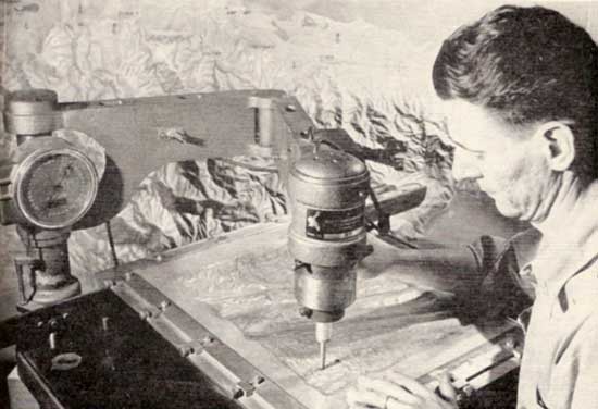
The US army used the manual terrain embossing technique to create shaded maps. That is, the models were photographed to produce relief shading for printed maps. For this purpose, a map is printed onto a plastic sheet which is then manually formed using the map information as guidance. The forming is done with differently formed styluses on an underlay of rigid foam plastic. The drainage system and the mountain ridges are used as guidelines. Besides, the use as template for creating shaded relief, Radar simulations and visibility studies could also be done. Other countries developed comparable techniques, but all of them are limited by the insufficient depiction of steep mountains. [2]